The diversity of landscape and scenery in Washington continues to amaze. Quaint harbor towns, island sanctuaries, big cities, glacier capped mountains, and stunning beaches exist all within a few hours, or even minutes. Our final stop in the Evergreen State added to that list — volcanoes. We moved to Silver Creek, WA, in the heart of the Cascade Volcanic Arc, to take in the sights at Mount St. Helens National Volcanic Monument and Mount Rainier National Park.
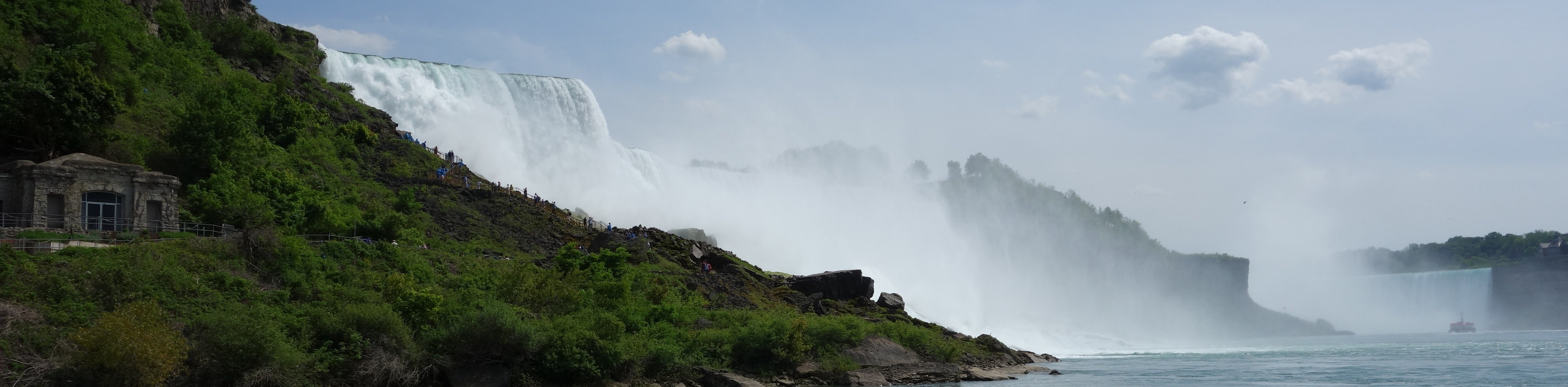
Mt. St. Helens catastrophically erupted on May 18, 1980. An earthquake and massive landslide preceded the eruption. When all was said and done, Mt. St. Helens stood 1300 feet shorter and the landscape on the north side of the mountain was forever changed.

Our approach to the Johnston Ridge Observatory at Mt. St. Helens followed the Toutle River valley. Massive lahars of ash, trees, and debris hurled through this valley on eruption day before slamming into I-5 over 40 miles away.

The Forest Learning Center, sponsored by Weyerhaeuser, now stands at this location. We enjoyed learning about forestry, the impact of the eruption on the environment, forestry decisions made in the wake of the eruption, and the replanting of a substantial part of the devastated forest. Because Weyerhaeuser cleared and replanted much of its land, the approach to the park is greener and healthier than you might expect.
On the other hand, the government intentionally left the land within the Monument boundaries to recover on its own. That provides for a stark contrast and an interesting case study for scientists. While showing some signs of recovery, the land inside the park, especially close to the mountain, more closely resembles a moonscape.
 Nevertheless, elk herds roam the park (or sit as the case may be).

Mt. St. Helens provided a peek at what might happen if/when Mt. Rainier erupts. But Mt. Rainier is bigger, much bigger. Mt. Ranier stands over 14,000 feet tall and has a topographic prominence of over 13,000 feet. 26 glaciers adorn its peak. Lahars created by melting glaciers could impact Tacoma and Seattle if Mt. Ranier were to erupt. But enough about what might happen, what did we do?
We hiked from the Paradise Visitor Center to Nisqually Glacier. I’d like for the pictures to tell the story, but they don’t do Rainier justice. Neither will any words I can come up with.
With Rainier in front and the glacier carved peaks of the Tatoosh Range behind us, we ascended.

 Killer ground squirrels stood ready to pounce.

Ever present, the mountain loomed, beckoning us closer


Steep and rocky climbs signaled we were nearing the glacier.

Success!


")
")


Love reading your trip reports. Say hi to the Goonies for me.
Simply Awe inspiring!
Wow.. now that is a mountain.
Had a great run here last night. The platform is stable and the winning feeling is addictive. Give dobrowinbet a try if you feel lucky.